Amsterdam, block by block
Amsterdam has been arguing with itself about how big it should be since the 17th century. Municipal population is around 941,927, the wider Metropoolregio about 2.62 million. More than half of residents have a non-Dutch background, and recent arrivals (anyone here under ten years) make up roughly 19%, double the 2013 share.
The friction shows in the numbers. The 2021 "Tourism in balance" bylaw set a cap of 20 million overnight stays a year; the city did 22.9 million in 2024 plus 26.7 million day trippers. Around 36-38% of trips inside the city are by bike. The 30 km/h citywide speed limit took effect on 8 December 2023.
The four neighborhoods below trace the canal-ring expansion outward, roughly in the order each got "discovered."
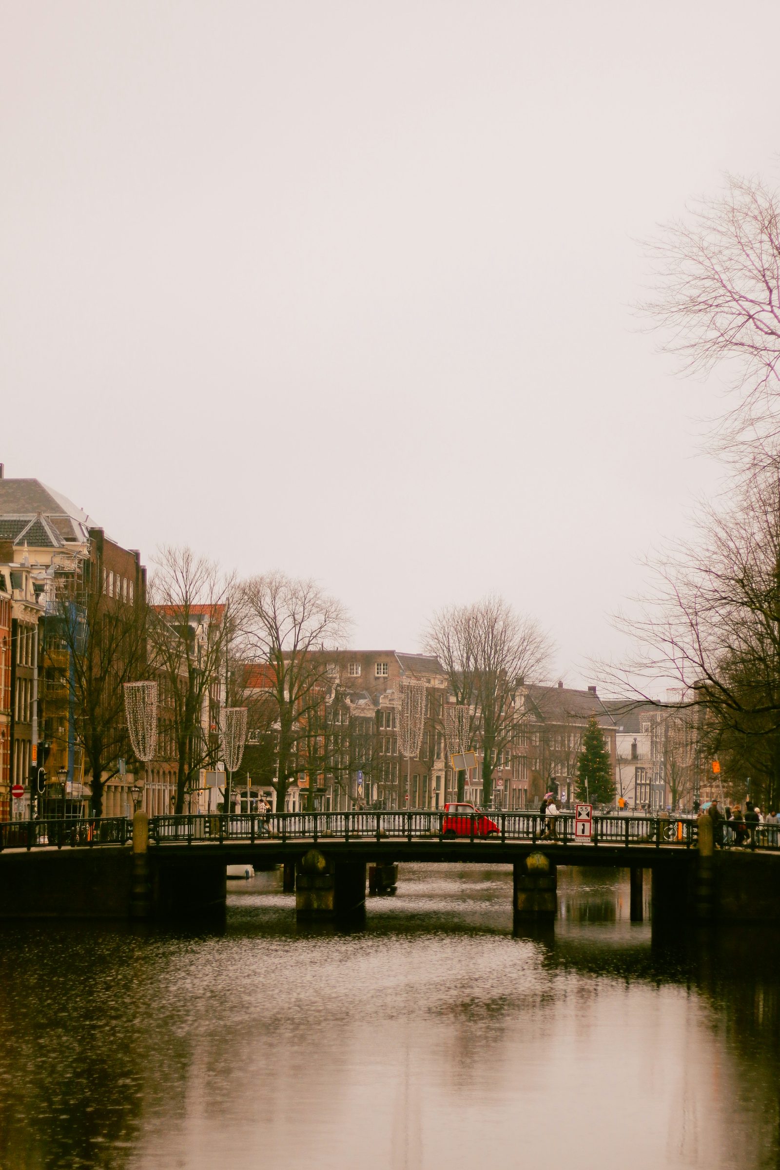
De Jordaan
Photo: Andres Oropeza / Unsplash
The Jordaan is what Amsterdam looks like when it wins.
Construction started in 1612 west of the new Prinsengracht, as the city's third great expansion. It was meant to be the working-class quarter, laid out on medieval ditches and field paths, which is why the streets cut at an odd angle to the canal ring next door. The name probably comes from the French jardin, brought by Huguenot refugees who arrived alongside Flemings and Sephardic Jews. Most streets are still named after trees and flowers. Around 1900 about 80,000 people lived here in tiny houses; today it's 20,000.
Two working-class uprisings shaped the place. The Palingoproer of July 1886 started when police cut down the rope used for the (already banned) eel-pulling game over the Lindengracht; the army got called in, fired live rounds, 26 people died. The Jordaanoproer of July 1934 was a Depression-era protest against a cut to unemployment benefits: five killed, 56 wounded. In the 1970s the city wanted to demolish big parts of the neighborhood and put up modern blocks. The residents fought back and the streets stayed.
Het Parool was already calling out the change on 13 July 1979: "strangers think you can still find the Amsterdam working class in the Jordaan. They will be deceived. [...] Gentrification is what it is called in English." Apartments now go for around €9,000-€10,000 per square metre, roughly twice the price of a comparable flat in Noord or Zuidoost.
The brown bars are the part that survived. Café Chris on Bloemstraat 42 has claimed since 1624 to be the oldest bar in the Jordaan, built (the lore says) as a lunch spot for the workers putting up the Westerkerk next door. Café 't Papeneiland at Prinsengracht 2 sits in a 1642 building with a tunnel from the cellar that once led to a hidden Catholic church across the canal. De Twee Zwaantjes on Prinsengracht 114 still hosts the levenslied sing-along: accordion, smartlappen, locals belting out songs they all know.
The Anne Frank House at Prinsengracht 263-267 had 1,208,327 visitors in 2024, still below the 2019 record. The queue starts on the gracht around 9am.
De Pijp
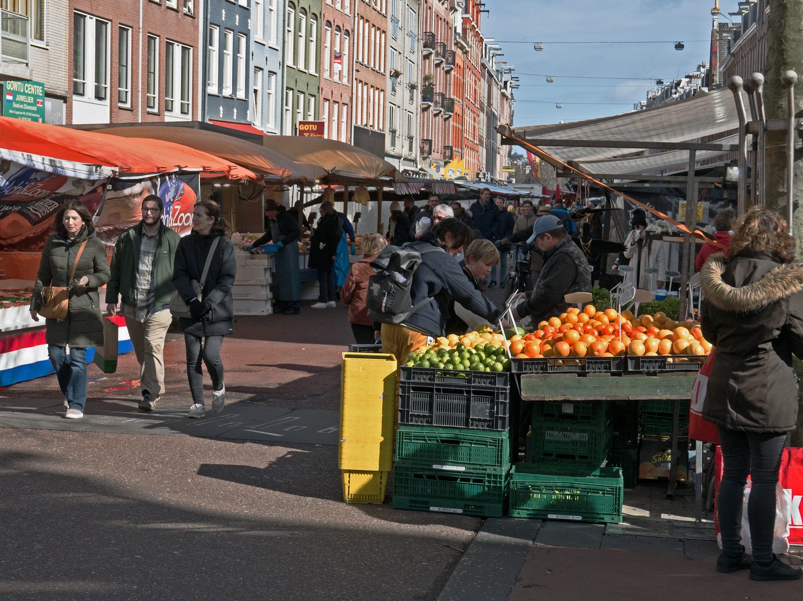
Photo: Fons Heijnsbroek / Wikimedia Commons (CC0)
De Pijp is what Amsterdam looks like when it's still arguing.
The neighborhood was built fast and cheap between roughly 1876 and 1900 under Plan Kalff, after the city scrapped Van Niftrik's grand 1866 vision for a tighter speculative grid. Narrow streets, closed blocks, no green space, fast private money. That layout is basically why De Pijp still feels the way it does: dense, intense, hard to drive through.
Heineken brewed at Stadhouderskade 78 from 1867 until 1988, when production moved to Zoeterwoude. The old building reopened as a visitor centre three years later, rebranded "Heineken Experience" in 2001.
The Albert Cuypmarkt anchors daily life. Established by municipal decree on 1 July 1905, expanded to six days in 1912, it now runs about 260 stalls Monday to Saturday, the largest outdoor market in the Netherlands. You can buy Vietnamese spring rolls next to a stroopwafel iron next to a guy selling socks.
The post-1975 Surinamese arrival shows up around the corner. Warung Spang Makandra on Gerard Doustraat 39 has been doing Surinamese-Javanese food since 1978; the name means "together share" in Sranan. About half of Suriname's population took Dutch citizenship after independence on 25 November 1975, and many landed in De Pijp because rents were still low.
Sarphatipark opened in 1885, named for Samuel Sarphati, the 19th-century Jewish doctor and city planner who built Amsterdam's first cheap-bread factory in 1855. The Nazi-era city government renamed it Bollandpark in 1942 because Sarphati was Jewish; the original name came back in 1945.
The newer wave is on the Ceintuurbaan: SLA opened its flagship salad bar at no. 149 in July 2013 and is now a chain across the country. De Pijp now goes for €9,000-€12,500 per square metre. The neighborhood gets called Brooklyn-of-Amsterdam in tourist articles. Most people who actually live there hate that.
Noord
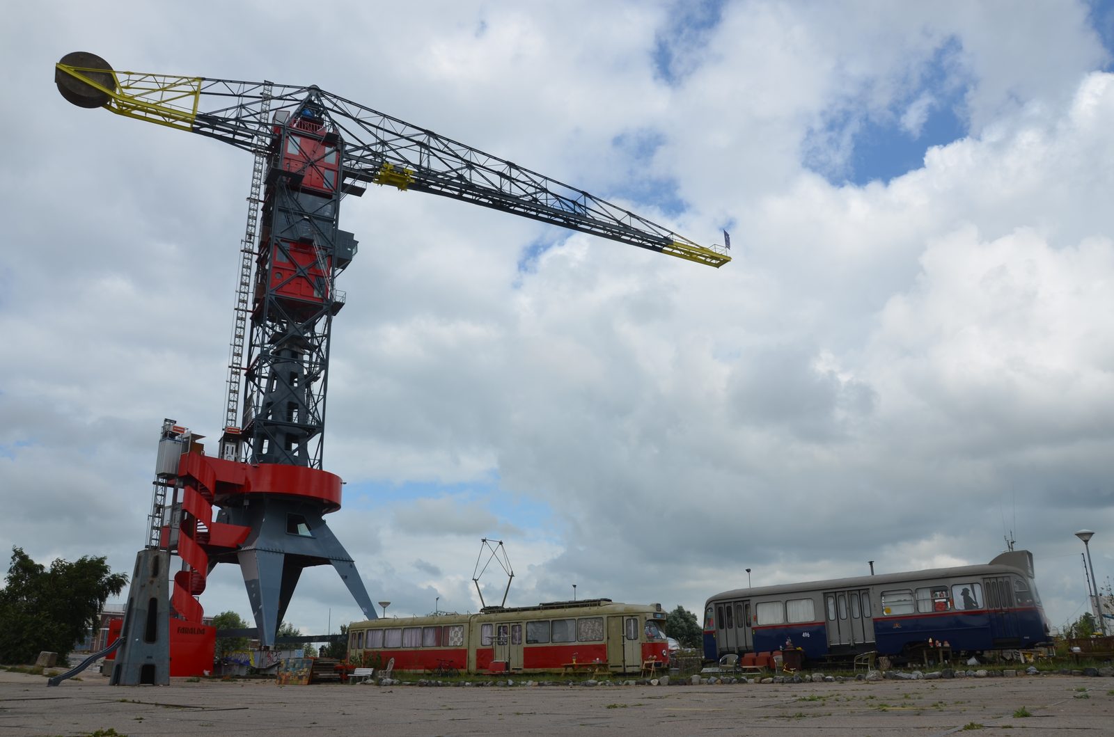
Photo: Steven Lek / Wikimedia Commons (CC BY-SA 4.0)
Noord is what Amsterdam looks like when the metro arrives.
Until 30 October 1968, when Queen Juliana opened the IJtunnel, you could only get there by boat. The Noord-Zuidlijn (metro line 52) opened on 22 July 2018 after 25 years of planning and a final cost of roughly €3.1 billion. Noord went from "the part of Amsterdam you don't go to" to a four-minute metro ride from De Pijp.
The GVB ferries behind Centraal Station are still free for pedestrians and cyclists and run around the clock. When the boat hits the north quay a wave of cyclists pours off and scatters in five directions at once.
The shipyard is the centre of the new Noord. The Nederlandsche Dok en Scheepsbouw Maatschappij, formed on 27 February 1946, was once the largest in the country. Bankruptcy filed in 1985. The 90-hectare site sat empty, got squatted in the 1990s, redevelopment started around 1999. The IJ-Hallen flea market has run inside the old shipbuilding halls since 1994, about 750 outdoor stalls in summer, usually called the biggest in Europe.
Eye Filmmuseum on IJpromenade 1 opened in April 2012; the white origami shape on the waterfront is the first thing you see from the ferry. The A'DAM Toren next door, finished in 1971 as Royal Dutch Shell's research HQ, reopened in 2016 with the "Over the Edge" swing on the roof at about 100 metres up.
Pllek opened on Tt. Neveritaweg 59 in 2012, built mostly from old shipping containers, with a small artificial beach on the IJ. De Ceuvel on Korte Papaverweg 4 opened two years later: old houseboats on land, surrounded by phytoremediation plants cleaning polluted soil.
Square-metre prices in Noord run roughly €6,000-€8,000 against €10,000-€12,000 in Centrum and Zuid. Around NDSM they reportedly jumped 20-25% in two to three years. The Buiksloterham development, on a former heavy-industry zone with soil polluted by zinc, nickel and copper, plans 8,000+ homes and 30% social housing.
UvA researchers in 2025 found long-term residents mostly happy with the upgrades but worried their kids won't be able to stay. One: "If you don't see that Noord has been gentrified, you must be blind."
Oost
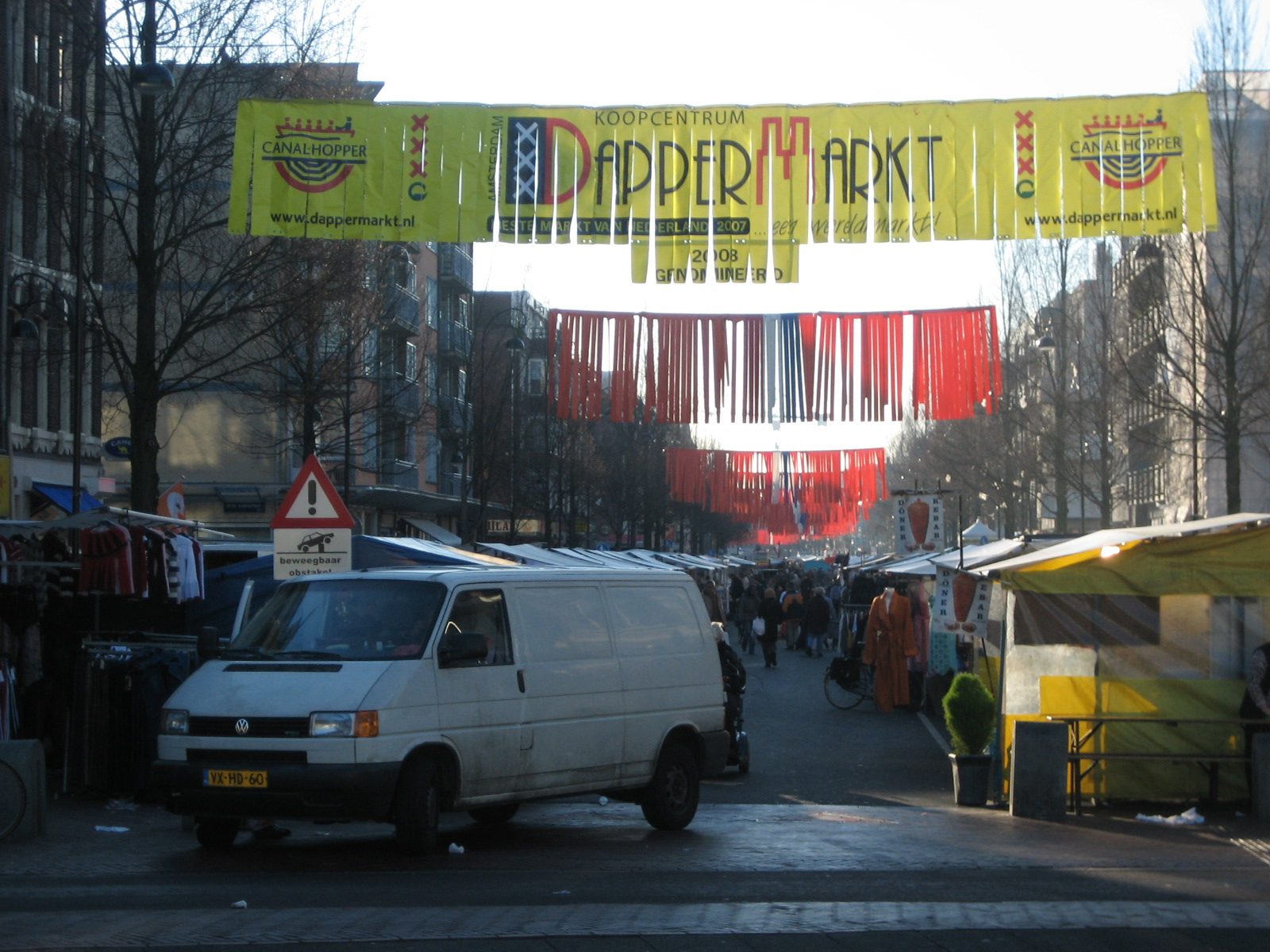
Photo: Erik Joling / Wikimedia Commons (CC BY-SA 2.5)
Oost is the east where the city keeps remembering things.
Walk east from Centraal Station for twenty minutes, cross the Singelgracht, and Amsterdam stops looking like the postcards. The houses get lower, the canals straighter, the languages louder. The Indische Buurt and Dapperbuurt are two adjacent worker districts built between the 1880s and 1910s on Jan Kalff's 1877 expansion plan. Indische Buurt streets were named after Dutch East Indies islands starting in 1902: Javastraat, Sumatrastraat, Borneostraat, Balistraat, Molukkenstraat.
The Tropenmuseum at Linnaeusstraat 2 sits in a neo-renaissance building Queen Wilhelmina opened on 9 October 1926. The collection started in Haarlem in 1864 as the Koloniaal Museum and is still wrestling with how to show a few centuries of colonial loot.
The Dappermarkt has been on Dapperstraat since 1910. About 250 stalls, the second-largest market in the city after Albert Cuyp and the most diverse: Surinamese roti, Turkish bread, Moroccan olives, Dutch raw herring, all in 600 metres.
Café De Ysbreeker at Weesperzijde 23 has been there since 1702, named after the icebreaker boat that sat out front cracking the ice on the Amstel. Roopram Roti opened the Dapperbuurt branch on Eerste van Swindenstraat 4 in May 2004; the family business goes back to 1967. Wilde Zwijnen on Javaplein 23 opened in April 2010 as the first upmarket restaurant in Oost: locals call that the moment the gentrification was real.
On 2 November 2004, a little over twenty years ago, Theo van Gogh was murdered on Linnaeusstraat at the corner of Tweede Oosterparkstraat, in front of the borough office. He was cycling to work. Mohammed Bouyeri, a 26-year-old Dutch-Moroccan, shot him eight times, then cut his throat and pinned a five-page note to his chest with a knife. He was sentenced the following summer to life without parole.
At the 2024 commemoration, the sister Jantine van Gogh said simply: "We missen Theo enorm, ook in publiek debat." The corner has a small bronze plaque in the pavement. Most people walk past without seeing it.
The Indische Buurt has gained an estimated 15-20% in property value in two to three years. Two waves of state-led regeneration in 2009 and 2016 pushed small Turkish and Moroccan shops out of Javastraat and brought in espresso bars and concept stores. The Maghreb butcher next to the third-wave bakery: it actually exists like that, for now.
Photo: Lisha Riabinina / Unsplash
The cap on tourist stays is 20 million. The city did 22.9 million in 2024. The gemeente has since admitted the cap was never legally enforceable. Residents are suing.
See the full Amsterdam neighborhood scores or explore the map. Data from OpenStreetMap.